
The NZNTT is actively seeking updated information for all trees in the register. If you have information about this tree that we don't currently have recorded, or wish to advise of an inaccuracy please use our information submission form to help us build a complete profile of this tree.
It has been more than ten years since we recorded a measurement for this tree. If you are able to provide us with new measurements please fill out the information submission form for this tree.
Tree Information x
| Identifier: | OR/0794 |
|---|---|
| Tree Type: | Single |
| Registered By: | Cadwallader, BG |
| Registration Category: | Notable tree/s – Local interest |
| General Notes: |
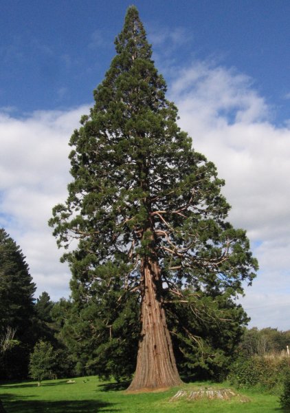
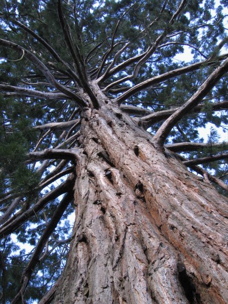
The larger of two trees in this reserve and near the road edge. The other tree is taller OR/0742. The information panel says that the area has been a popular picnic spot since the 1890's. The trees are part of the original old homestead garden adjacent to the reserve.
The New Zealand Arboricultural Association Arbor camp was held at this location in 2010 at which time many of the trees, including this one, were given some long overdue care. |
Single Tree Details
| Genus: | Sequoiadendron | |
|---|---|---|
| Species: | giganteum | |
| Common names: | giant sequoia, giant redwood, Sierra redwood, Wellingtonia | |
| Height: | 44.40m | |
| Height measurement method: | Laser Nikon Forestry 550 | |
| Height Comments: | (none) | |
| Girth: | 1180 cm | |
| Girth measurement height: | 1.4 m | |
| Girth Comments: | (none) | |
| Diameter: | 375.6 cm | |
| Crown Spread A: | 16.50m | |
| Crown Spread B: | 18.00m | |
| Avg. Crown Spread: | 17.25m | |
| Actual Planting Date: | actual date not specified | |
| Approx. Planting Date: |
C.1850 e.g. circa. 1860 |
|
| Current Age: | 175 years | |
| Tree Health Description: | In better health than the other tree. Some mower damage to the base. | |
| Tree Form Type: | Single Trunk | |
| Number of Trunks: | 1 | |
| Tree Form Comments: | The tree has a double top at 40m. Broader at the base from its open grown position. | |
| Champion Tree Score: | 624 | |
| Local Protection Status: | Unknown | |
| Tree Present: | Yes | |
| STEM Score: | 0 |
Observations
| Date | Observer | Action |
|---|---|---|
| 02 Apr 2011 | Cadwallader, BG |
Location
|
|||||||||||||||||||||
Images
| Preview | Credit | Date |
|---|---|---|
 |
BGC | 01 Apr 2011 |
 |
BGC | 01 Apr 2011 |
 |
BGC | 01 Apr 2011 |