The NZNTT is actively seeking updated information for all trees in the register. If you have information about this tree that we don't currently have recorded, or wish to advise of an inaccuracy please use our information submission form to help us build a complete profile of this tree.
It has been more than ten years since we recorded a measurement for this tree. If you are able to provide us with new measurements please fill out the information submission form for this tree.
Tree Information x
| Identifier: | WCR/0954 |
|---|---|
| Tree Type: | Single |
| Registered By: | Cadwallader, B.G. |
| Registration Category: | Notable tree/s – Local interest |
| General Notes: |
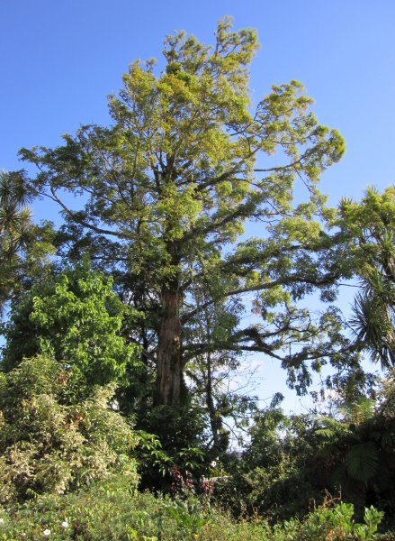
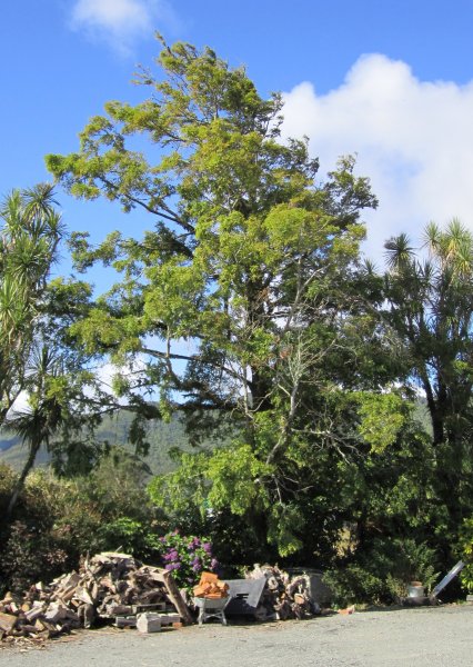
A very rare tree on the West Coast. The tree appears in S.W. Burstall's 1974 Forest Mensuration Report No. 21 (unpublished), Historic and Notable Trees of New Zealand: Marlborough, Nelson, Westland and is recorded as being 'planted by Jack Baty in 1951'. The tree is a first generation dawn redwood and perhaps the most isolated in the country. No history is available of how Mr. Baty obtained his specimen (Cadwallader 2012).
The tree is listed as item number 23 in SCHEDULE 2 - HISTORIC TREES REGISTER - on the Grey District Plan. |
Single Tree Details
| Genus: | Metasequoia | |
|---|---|---|
| Species: | glyptostroboides | |
| Common names: | dawn redwood, shui-shan, water fir | |
| Given Name: | The Jack Baty Tree | |
| Height: | 17.00m | |
| Height measurement method: | Clinometer - SUUNTO | |
| Height Comments: | (none) | |
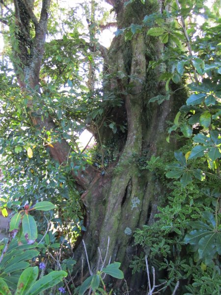
| Girth: | 351 cm | |
| Girth measurement height: | 0.6 m | |
| Girth Comments: | Low branch at 1.4 | |
| Diameter: | 111.7 cm | |
| Crown Spread A: | 9.00m | |
| Crown Spread B: | 11.50m | |
| Avg. Crown Spread: | 10.25m | |
| Actual Planting Date: | 1951 | |
| Approx. Planting Date: |
e.g. circa. 1860 |
|
| Current Age: | 74 years | |
| Tree Health Description: | In good condition considering its exposed situation. Some recent storm damage is visible. Some decay at the base (Jan 2012). | |
| Tree Form Type: | Single Trunk | |
| Number of Trunks: | 1 | |
| Tree Form Comments: | A tree largely modified by the influence of the wind over the years. | |
| Champion Tree Score: | 202 | |
| Local Protection Status: | Yes | |
| Tree Present: | Yes | |
| STEM Score: | 0 |
Observations
| Date | Observer | Action |
|---|---|---|
| 21 Jan 2012 | Cadwallader, B.G. | |
| 03 Nov 1994 | Grey District Council |
Location
|
|||||||||||||||||||||
Images
| Preview | Credit | Date |
|---|---|---|
 |
Brad Cadwallader | 21 Jan 2012 |
 |
Brad Cadwallader | 21 Jan 2012 |
 |
Brad Cadwallader | 21 Jan 2012 |