
The NZNTT is actively seeking updated information for all trees in the register. If you have information about this tree that we don't currently have recorded, or wish to advise of an inaccuracy please use our information submission form to help us build a complete profile of this tree.
It has been more than ten years since we recorded a measurement for this tree. If you are able to provide us with new measurements please fill out the information submission form for this tree.
Tree Information x
| Identifier: | AR/0753 |
|---|---|
| Tree Type: | Single |
| Registered By: | Cadwallader, B.G. |
| Registration Category: | Notable tree – International interest |
| General Notes: |
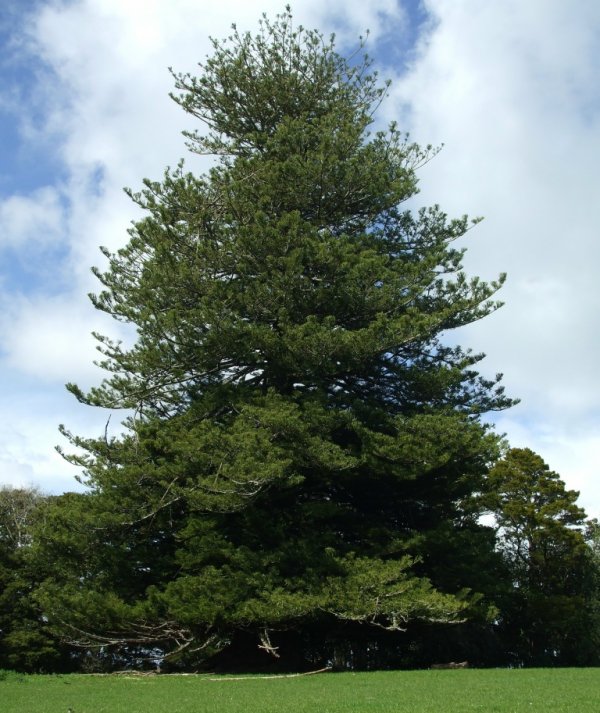
In 1853 Captain Hugh Grange, who owned and ran a coastal schooner called "Tattycorum", bought 200 acres on the banks of the Mahurangi River. Capt. Grange built his house on the SE corner of this property where there was easy tidal access to a branch of the Te Whau (Dawson's) Creek. The only access to the property until 1912 was from the river. The house was named "Harbour View" as there was a clear view down to the river mouth from the homestead. This house was later dismantled and taken to Lilburn Street in Warkworth and re-erected for Hugh Grange's widow. An oak seedling and a Norfolk Island pine were planted beside the gate to the homestead. The giant oak tree collapsed in a gale in 1982, but the Norfolk pine is one of the largest of its kind and still stands proud today 160 years on. Measurements taken in 2009 show that it has the largest known girth of any Norfolk Island Pine in the world! The nearby oak and two others on the property were grown from acorns off the original oak that fell. Compiled from notes taken from www.mihiraulodge.co.nz see also www.conifers.org
The main leader has gone, resulting in a somewhat thin and shabby looking top. Lyn Wade reports 'that it was lost during the Second World War when a girl who was helping out on the farm was dared to climb to the top. To prove she had she broke off the tip. The tree died back about 8 metres after this. When my father, Dr. Max Hamilton retired back to the family property in 1970 the Norfolk Pine had two growing tips one of which he had removed'. The tree is a little less magnificent as a result. Gould, B. 2010. The tree is listed as H607 on the Rodney District Council Appendix 17c - Historic and Culturally Significant Protected Trees. |
Single Tree Details
| Genus: | Araucaria | |
|---|---|---|
| Species: | heterophylla | |
| Common names: | Norfolk Island pine, | |
| Given Name: | The Grange Norfolk | |
| Height: | 34.60m | |
| Height measurement method: | Laser Impulse 200 LR | |
| Height Comments: | (none) | |
| Girth: | 997.7 cm | |
| Girth measurement height: | 1.37 m | |
| Girth Comments: | 853.2cm @ 2 m | |
| Diameter: | 317.6 cm | |
| Crown Spread A: | 23.60m | |
| Crown Spread B: | 23.60m | |
| Avg. Crown Spread: | 23.60m | |
| Actual Planting Date: | actual date not specified | |
| Approx. Planting Date: |
c1850 e.g. circa. 1860 |
|
| Current Age: | 175 years | |
| Tree Health Description: | Some crown dieback which is expected for a tree of this age. Some pressure from livestock is evident. | |
| Tree Form Type: | Single Trunk | |
| Number of Trunks: | 1 | |
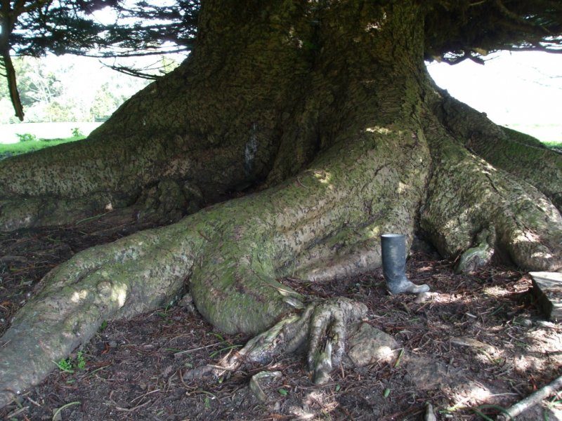
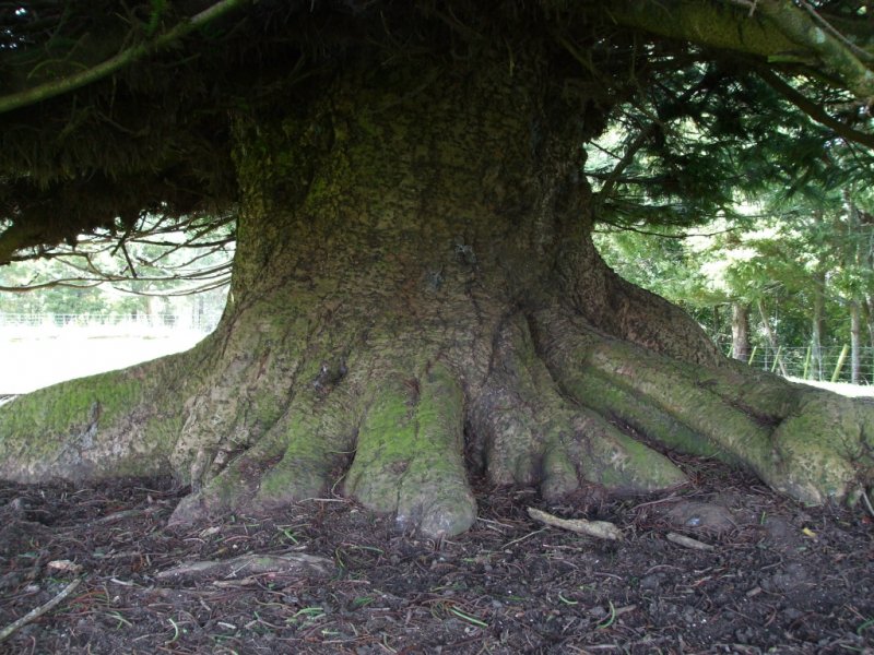
| Tree Form Comments: | The tree has a massive trunk and buttresses. The top 3-4m is missing. | |
| Champion Tree Score: | 526 | |
| Local Protection Status: | Yes | |
| Tree Present: | Yes | |
| STEM Score: | 0 |
Observations
| Date | Observer | Action |
|---|---|---|
| 14 Apr 2009 | Van Pelt, R. |
Location
|
|||||||||||||||||||||
Images
| Preview | Credit | Date |
|---|---|---|
 |
Lyn Wade | 31 Aug 2010 |
 |
Lyn Wade | 31 Aug 2010 |
 |
Lyn Wade | 31 Aug 2010 |