
The NZNTT is actively seeking updated information for all trees in the register. If you have information about this tree that we don't currently have recorded, or wish to advise of an inaccuracy please use our information submission form to help us build a complete profile of this tree.
Tree Information x
| Identifier: | TSR/0696 |
|---|---|
| Tree Type: | Single |
| Registered By: | Cadwallader B.G. |
| Registration Category: | Notable tree – International interest |
| General Notes:
|
The largest recorded girth for this species outside of its natural range. NZNTT 2010
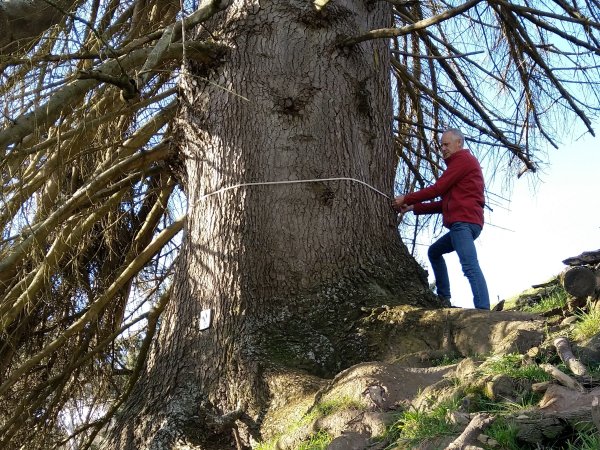
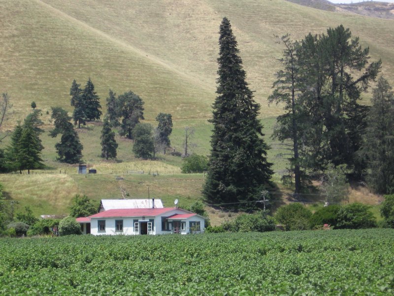
An impressive tree in its natural form with branches to the ground. There are a number of other large exotic trees on this farm that may have come from the old Tapawera Forestry nursey site nearby. Livestock activity under the tree has exposed the large surface roots. The tree is listed on the Tasman Resource Management Plan schedule as PT838 (Cadwallader, B.G., 2010). Allan Herbarium voucher specimen CHR 610025 - ID 2010/0079 |
Single Tree Details
| Genus: | Abies | |
|---|---|---|
| Species: | nordmanniana | |
| Common names: | Caucasian fir, | |
| Height: | 47.00m | |
| Height measurement method: | Laser Nikon Forestry 550 | |
| Height Comments: | (none) | |
| Girth: | 580 cm | |
| Girth measurement height: | 0.8 m | |
| Girth Comments: | Taken at .8 on top side due to steep grade and tree flare. | |
| Diameter: | 184.6 cm | |
| Crown Spread A: | 20.00m | |
| Crown Spread B: | 20.00m | |
| Avg. Crown Spread: | 20.00m | |
| Actual Planting Date: | actual date not specified | |
| Approx. Planting Date: |
e.g. circa. 1860 |
|
| Current Age: | not known years | |
| Tree Health Description: | The tree has suffered an attack of fir adalgid since last measured. | |
| Tree Form Type: | Single Trunk | |
| Number of Trunks: | 1 | |
| Tree Form Comments: | An open grown specimen with branches to the ground. The tree has been wind pruned and leans to the north. | |
| Champion Tree Score: | 399 | |
| Local Protection Status: | Yes | |
| Tree Present: | Yes | |
| STEM Score: | 0 |
Observations
| Date | Observer | Action |
|---|---|---|
| 04 Aug 2023 | Cadwallader, B.G. | |
| 07 Sep 2010 | Cadwallader, B.G. |
Location
|
|||||||||||||||||||||
Images
| Preview | Credit | Date |
|---|---|---|
 |
Brad Cadwallader | 04 Aug 2023 |
 |
Brad Cadwallader | 07 Jan 2009 |