The NZNTT is actively seeking updated information for all trees in the register. If you have information about this tree that we don't currently have recorded, or wish to advise of an inaccuracy please use our information submission form to help us build a complete profile of this tree.
It has been more than ten years since we recorded a measurement for this tree. If you are able to provide us with new measurements please fill out the information submission form for this tree.
Tree Information x
| Identifier: | WTR/1291 |
|---|---|
| Tree Type: | Single |
| Registered By: | Arthur, G. |
| Registration Category: | Notable tree – International interest |
| General Notes: |
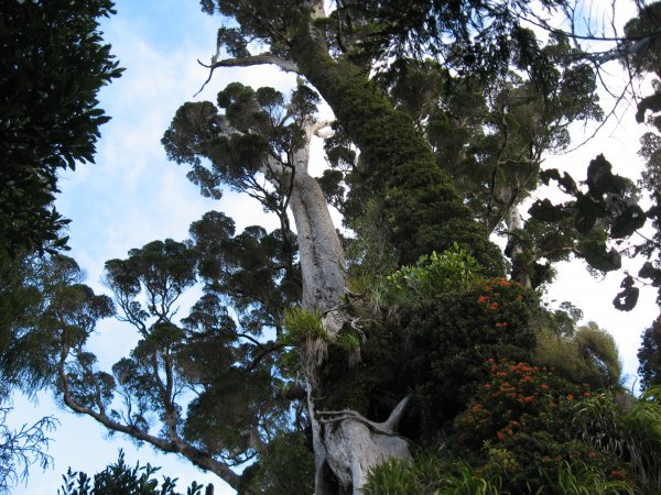
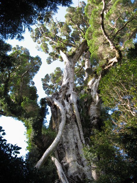
This tree is a very large northern rata in Akatarawa Forest, near Pram Track. Its girth and height are virtually identical (within practical measuring limits) to those of the Karapoti Rata (WTR/0976), and so the Whakatikei Rata is regarded as New Zealand's co-champion largest northern rata in NZ. The tree should not be confused with another large rata nearby. This other tree is 4 metres in diameter with a large canopy, 100 metres to the northwest, and closer to Pram Track (Arthur, G. 2015).
|
Single Tree Details
| Genus: | Metrosideros | |
|---|---|---|
| Species: | robusta | |
| Common names: | northern rata, | |
| Given Name: | Whakatikei Rata | |
| Height: | 39.00m | |
| Height measurement method: | Clinometer | |
| Height Comments: | Geometrical solution using clinometer, compass, GPS and tape | |
| Girth: | 1555 cm | |
| Girth measurement height: | 1.5 m | |
| Girth Comments: | Girth height varied from 1.5 to 4 metres because of ground slope. | |
| Diameter: | 495 cm | |
| Crown Spread A: | 30.00m | |
| Crown Spread B: | 20.00m | |
| Avg. Crown Spread: | 25.00m | |
| Actual Planting Date: | actual date not specified | |
| Approx. Planting Date: |
Unknown e.g. circa. 1860 |
|
| Current Age: | not known years | |
| Tree Health Description: | A mature tree with no serious deterioration. Age well over 1000 yrs. | |
| Tree Form Type: | Multi-trunk | |
| Number of Trunks: | 10 | |
| Tree Form Comments: | Several very large upper branches arising from multi-component trunk. | |
| Champion Tree Score: | 0 | |
| Local Protection Status: | No | |
| Tree Present: | Yes | |
| STEM Score: | 0 |
Observations
| Date | Observer | Action |
|---|---|---|
| 23 Apr 2015 | Arthur, G. |
Location
|
|||||||||||||||||||||
Images
| Preview | Credit | Date |
|---|---|---|
 |
Gerald Arthur | 26 Mar 2015 |
 |
Gerald Arthur | 24 Aug 2014 |
 |
Gerald Arthur | 24 Aug 2014 |