The NZNTT is actively seeking updated information for all trees in the register. If you have information about this tree that we don't currently have recorded, or wish to advise of an inaccuracy please use our information submission form to help us build a complete profile of this tree.
It has been more than ten years since we recorded a measurement for this tree. If you are able to provide us with new measurements please fill out the information submission form for this tree.
Tree Information x
| Identifier: | AOTA/1152 |
|---|---|
| Tree Type: | Single |
| Registered By: | Maloney, A.D. |
| Registration Category: | Notable tree – International interest |
| General Notes: |
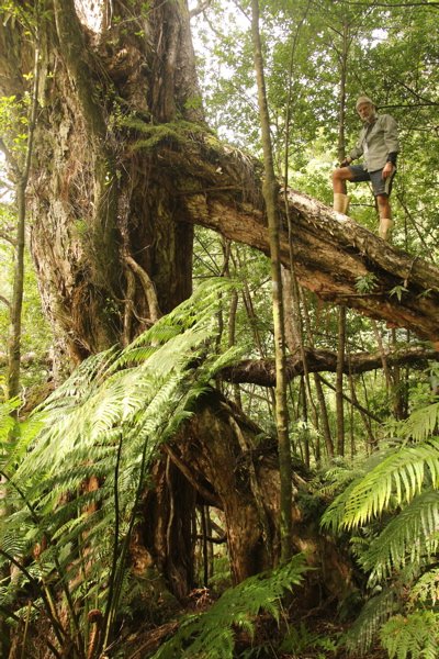
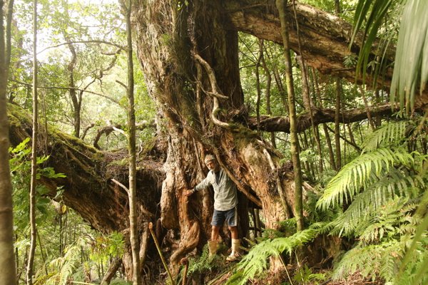
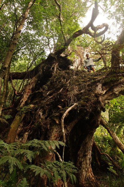
Probably the largest Kermadec pohutukawa on Raoul Island (and therefore the world), discovered on a ridge on the north side of the island. Its great size can probably be attributed to a huge prop root anchoring the tree to the uphill slope, which has probably stopped the tree being blown down by cyclones, the fate of most old pohutukawas on the island (Maloney, A.D. 2013).
|
Single Tree Details
| Genus: | Metrosideros | |
|---|---|---|
| Species: | kermadecensis | |
| Common names: | Kermadec Island pōhutukawa, | |
| Height: | 29.00m | |
| Height measurement method: | Clinometer | |
| Height Comments: | On a steep slope. 31m high if measured from the downhill side. | |
| Girth: | 870 cm | |
| Girth measurement height: | 1.4 m | |
| Girth Comments: | Girth height measured from the uphill side of the tree | |
| Diameter: | 276.9 cm | |
| Crown Spread A: | 34.00m | |
| Crown Spread B: | 20.00m | |
| Avg. Crown Spread: | 27.00m | |
| Actual Planting Date: | actual date not specified | |
| Approx. Planting Date: |
e.g. circa. 1860 |
|
| Current Age: | not known years | |
| Tree Health Description: | In good health | |
| Tree Form Type: | Single Trunk | |
| Number of Trunks: | 1 | |
| Tree Form Comments: | Single main trunk, but has two large prop roots (with girths of 230cm and 210cm) and a branch anastamosing with a nearby tree | |
| Champion Tree Score: | 460 | |
| Local Protection Status: | No | |
| Tree Present: | Yes | |
| STEM Score: | 0 |
Observations
| Date | Observer | Action |
|---|---|---|
| 01 Aug 2013 | Maloney, A.D., Pugsley, C. & Maclellan, G |
Location
|
|||||||||||||||||||||
Images
| Preview | Credit | Date |
|---|---|---|
 |
Andrew Maloney | 01 Aug 2013 |
 |
Andrew Maloney | 01 Aug 2013 |
 |
Andrew Maloney | 01 Aug 2013 |
 |
Andrew Maloney | 01 Aug 2013 |