The NZNTT is actively seeking updated information for all trees in the register. If you have information about this tree that we don't currently have recorded, or wish to advise of an inaccuracy please use our information submission form to help us build a complete profile of this tree.
It has been more than ten years since we recorded a measurement for this tree. If you are able to provide us with new measurements please fill out the information submission form for this tree.
Tree Information x
| Identifier: | MWR/G1094 |
|---|---|
| Tree Type: | Group |
| Registered By: | Judd, D.A. |
| Registration Category: | Notable tree/s – Local interest |
| General Notes: |
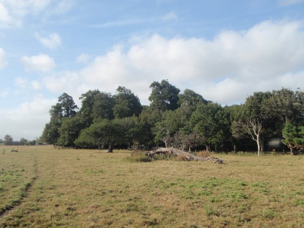
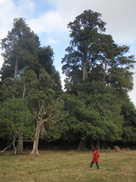
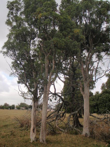
Remnant native tree groups within the city limits are rare things in the Manawatu. As a collection of trees this group is certainly worthy of recognition. Comprising no less that forty native species of tree, shrub and fern. The site comprises seven hectares enclosed within a fence and three hectares still existing in pasture outside the main group and yet to be fenced.
The property was purchased by John. P. Manderson in 1962, the previous owner was Bill Sutherland. The group was fenced in 1970 by John Manderson, prior to that it was a "Kill paddock" where cattle and sheep roamed to provide meat for the homestead (John Manderson interview 04.03.2103). The main dominant tree species comprise of kahikatea, titoki, totara, tawa, matai, maire and pukatea The key element to be listed within the group comprises 7 mature kahikatea (Judd, D.A. 2013). |
Group Details
| Group Type: | Mixed species | |
|---|---|---|
| Feature Tree Genus: | Dacrycarpus | |
| Feature Tree Species: | dacrydioides | |
| Feature Tree Common Names: | kahikatea, white pine | |
| Additional Feature Tree Genus: | ||
| Additional Feature Tree Common names: | ||
| Additional Feature Tree Species: | ||
| QE II Covenanted: | No | |
| Actual Planting Date: | actual date not specified | |
| Approx. Planting Date: |
e.g. circa. 1860 |
|
| Current Age: | not known years | |
| Tree Health Description: | Good all round conditon, however those trees outside the protection of the fence line are showing advanced signs of decline. | |
| Local Protection Status: | No | |
| Tree Present: | Yes | |
| Number of Trees: | 100 | |
| Area Covered: | 10 Hectares | |
| Group of Tree Type: | Bush Remnant |
Observations
| Date | Observer | Action |
|---|---|---|
| 07 Apr 2013 | Judd, D.A. |
Location
|
|||||||||||||||||||||
Images
| Preview | Credit | Date |
|---|---|---|
 |
Darryl Judd | 04 Mar 2013 |
 |
Darryl Judd | 04 Mar 2013 |
 |
Darryl Judd | 04 Mar 2013 |