The NZNTT is actively seeking updated information for all trees in the register. If you have information about this tree that we don't currently have recorded, or wish to advise of an inaccuracy please use our information submission form to help us build a complete profile of this tree.
Tree Information x
| Identifier: | AR/0730 |
|---|---|
| Tree Type: | Single |
| Registered By: | Cadwallader, B.G. Gould, B.C. |
| Registration Category: | Historic tree – National interest |
| General Notes:
|
This tree was given to the Scandrett family by their neighbour Sir George Grey, a former Governor of New Zealand and owner of nearby Kawau Island.
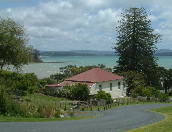
Located at the south eastern edge of Kawau Bay, Scandrett Regional Park encompasses Mullet Point and includes regenerating coastal forest, rocky headlands, an attractive beach and a historic farm precinct. Scandrett Regional Park takes its name from the Scandrett family, who farmed the land for more than 130 years. The Mullet Point area was known to Maori as Purahurawai "the expansive, sparkling waters". In those days Maori came from throughout the Hauraki Gulf to Kawau Bay (off Mullet Point) to catch and dry sharks for a winter food source. There are a number of sites of past Maori settlement within Scandrett Regional Park, including two headland pa. The land was the site of early shipbuilding during the 1850s and 1860s. When George Scandrett arrived from Ireland in 1863, its long farming history began. The historic Scandrett homestead, built in 1884, differs from many other early farmhouses in that it is made of an early type of concrete instead of the usual kauri timber. The associated farm buildings - a barn, milking shed (formerly a hen house), implement shed, dairy and cream sheds - are relics of a bygone era when access to the property was by sea. They are being restored and remain a central feature of the park. The Scandrett family continued to farm the land until it was sold to the Auckland Regional Council in 1998. Ref. www.arc.govt.nz |
Single Tree Details
| Genus: | Araucaria | |
|---|---|---|
| Species: | heterophylla | |
| Common names: | Norfolk Island pine, | |
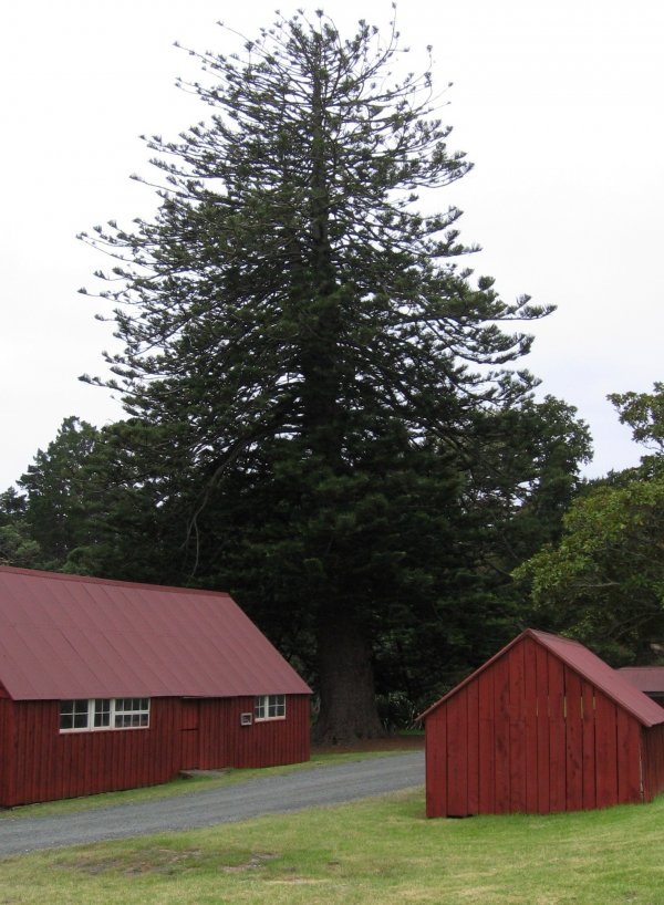
| Height: | 33.50m | |
| Height measurement method: | Laser Nikon Forestry 550 | |
| Height Comments: | Taken with a baseline of 40m | |
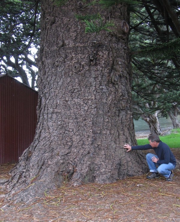
| Girth: | 724 cm | |
| Girth measurement height: | 1.4 m | |
| Girth Comments: | (none) | |
| Diameter: | 230.5 cm | |
| Crown Spread A: | 21.40m | |
| Crown Spread B: | 23.50m | |
| Avg. Crown Spread: | 22.45m | |
| Actual Planting Date: | actual date not specified | |
| Approx. Planting Date: |
circa 1870 e.g. circa. 1860 |
|
| Current Age: | 154 years | |
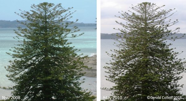
| Tree Health Description: | The canopy appears to have thinned out since observations made in 2008 (Collett, G. 2016) | |
| Tree Form Type: | Single Trunk | |
| Number of Trunks: | 1 | |
| Tree Form Comments: | The tree has developed a secondary stem at c18m. | |
| Champion Tree Score: | 413 | |
| Local Protection Status: | Unknown | |
| Tree Present: | Yes | |
| STEM Score: | 0 |
Observations
| Date | Observer | Action |
|---|---|---|
| 19 May 2016 | Collett, G., Maguiness, J. & Edge, D. | |
| 19 Mar 2010 | Cadwallader, B.C. & Gould, B.C. |
Location
|
|||||||||||||||||||||
Images
| Preview | Credit | Date |
|---|---|---|
 |
Gerald Collett | 19 May 2016 |
 |
Brad Cadwallader | 19 Mar 2010 |
 |
Brad Cadwallader | 19 Mar 2010 |
 |
Gerald Collett | 22 Nov 2008 |